
New topographic maps
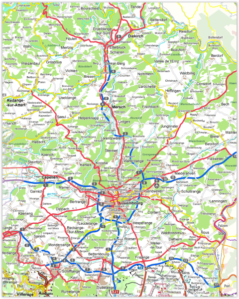
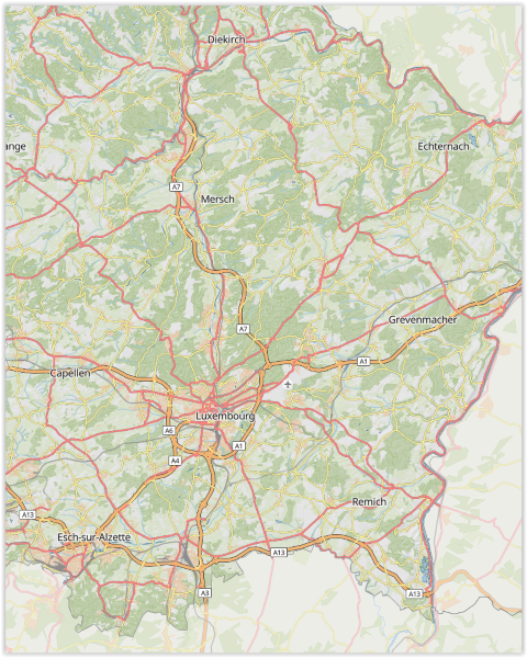
As with the road map in 2020, the topographic background maps for Luxembourg and its surroundings have been updated to use vector tiles technology.
This gives us a uniform style on all scales and the content of topographic maps is now updated weekly. You also have the option of defining your own topographic map by activating or deactivating categories of information such as transport axes, power lines, relief, height information, vegetation or even the nomenclature.
The settings remain stored in your browser. When you are logged in, they are loaded into your profile so that they can be reused on another computer.
Of course, the settings can also be used to create a custom background map and integrate it into your own website.
The display of vector tiles takes up less bandwidth than the old basemap and displays just as smoothly and sharply.
Advanced search
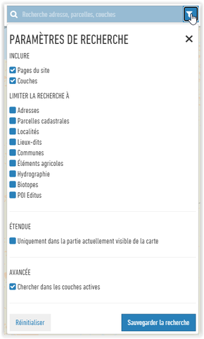
From now on it is possible to select the themes to which a search can be limited. The filter can be activated by clicking on the icon to the right of the search field.
You can thus include or exclude the pages of the static site of the geoportal or the layers, limit the search to certain topics such as for example addresses or cadastral parcels.
Extended mode allows you to search in currently activated layers, such as the names of bus stops, walking trails etc.
If, for example, you are looking for a bus stop:
Activate the bus stop layer and type in its name.
Finally, you have the option of showing only the search results that are in the current view (and not in the whole country).
3D model
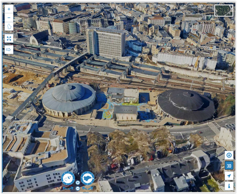
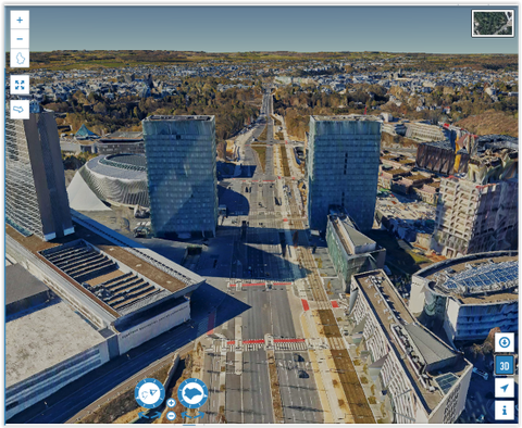
On the basis of the winter 2019 aerial images, ACT had a 3D model of the Luxembourg terrain calculated. A special mode has been introduced in the 3D view allowing to view this new 3D model. It is a first version of the model, with average precision, particularly in terms of the facades. The shots taken during 2020 will make it possible to provide a new, even more precise model in the future.
In order to view the model, you need a graphics card and a fairly powerful computer.
Example
Older News
Background switcher
The background layer selection menu has been replaced by a selection icon and has been moved to the right. The currently active background layer is highlighted by a small red square around the image
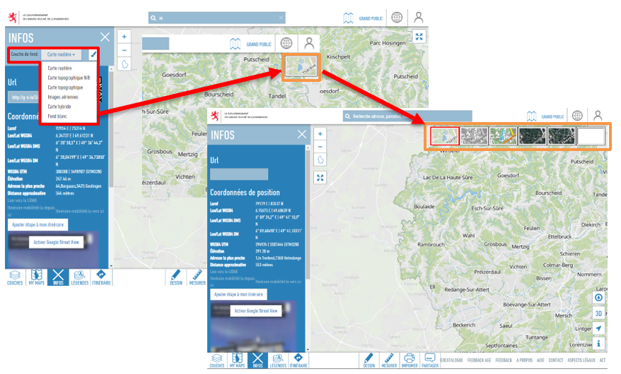
It is now also possible to view the metadata and the legend of the currently active background layer via the my layers section. Here the layer is found among your selected layers and it is possible to activate the legend and the metadata by clicking on the "I" next to the name of the layer
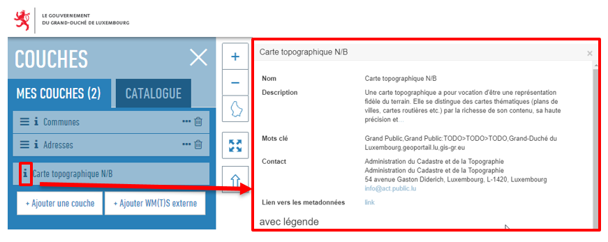
Tip: this also applies to all other layers whether among your selected layers and even in the catalog.
Vector style sharing
With the introduction of vector tiles we have introduced the possibility of creating your own cartographic style for the "road map". However, it was not possible to easily share this style with third parties.
With our recent change, it is now possible to share it via URL. Edit the map as you want and share your map style with whoever you want.
The style export functions are of course still available for those who want to use them.
Card Rotation
Until now the geoportal map viewer only allowed viewing Luxembourg in one direction (North up), now you can rotate the map on the central axis of the viewport
- On the computer by pressing the "ctrl" key (CMD on Mac OS) and dragging the mouse in the map while keeping the left key pressed.
- On mobile by placing 2 fingers apart on the screen and turning them
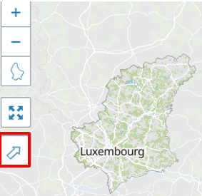
The arrow indicates the north of the country and allows you to rotate the map to its initial position by clicking on it. The labels always remain in a horizontal position in order to remain readable.
If you want to rotate the map to other dimensions, you can click on the "3D" icon
iFrame
While it has always been possible to incorporate the geoportal into your website, you needed some knowledge of JavaScript to do this.
In order to allow more people to use the geoportal in their web page, we now also offer an integration in the form of "iframe". Just copy / paste the configuration tip into a web page to find the same layers as in the geoportal.
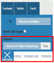
Create your cards, and use the share function to obtain the iFrame code to embed those if in your websites.
Print measurements
The printing function has been improved and now also incorporates such existing measures.
ATTENTION: We would like to remind you that this does not replace a surveyor or measurements on site
Even if the tool is made available and we strive to provide accurate data, the measurements remain approximate