
Hiking trails are part of the official datasets which have been integrated in a dediceted map porta, that has been created in collaboration with Luxemburg's tourism ministry. It is available at tourism.geoportal.lu
There is an enormous amount of information that is potentially interesting for tourist visiting the Grand-Duchy of Luxemburg, as is shown in the picture of the layer catalog below:
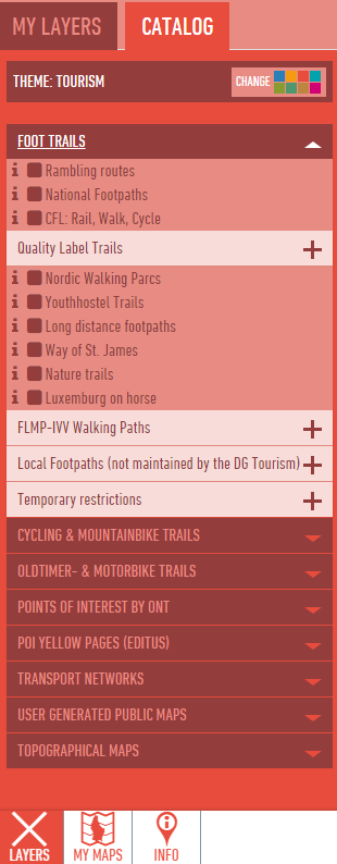
To find the hiking trail for your purpose, check the button of the layer you are interested of to have this data displayed in the map.
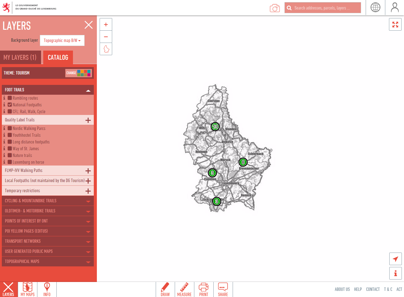
Use the search field on top of the map window to center the map on the address, town or region of your interest.
To see more information about any trail, click on the line to open it:
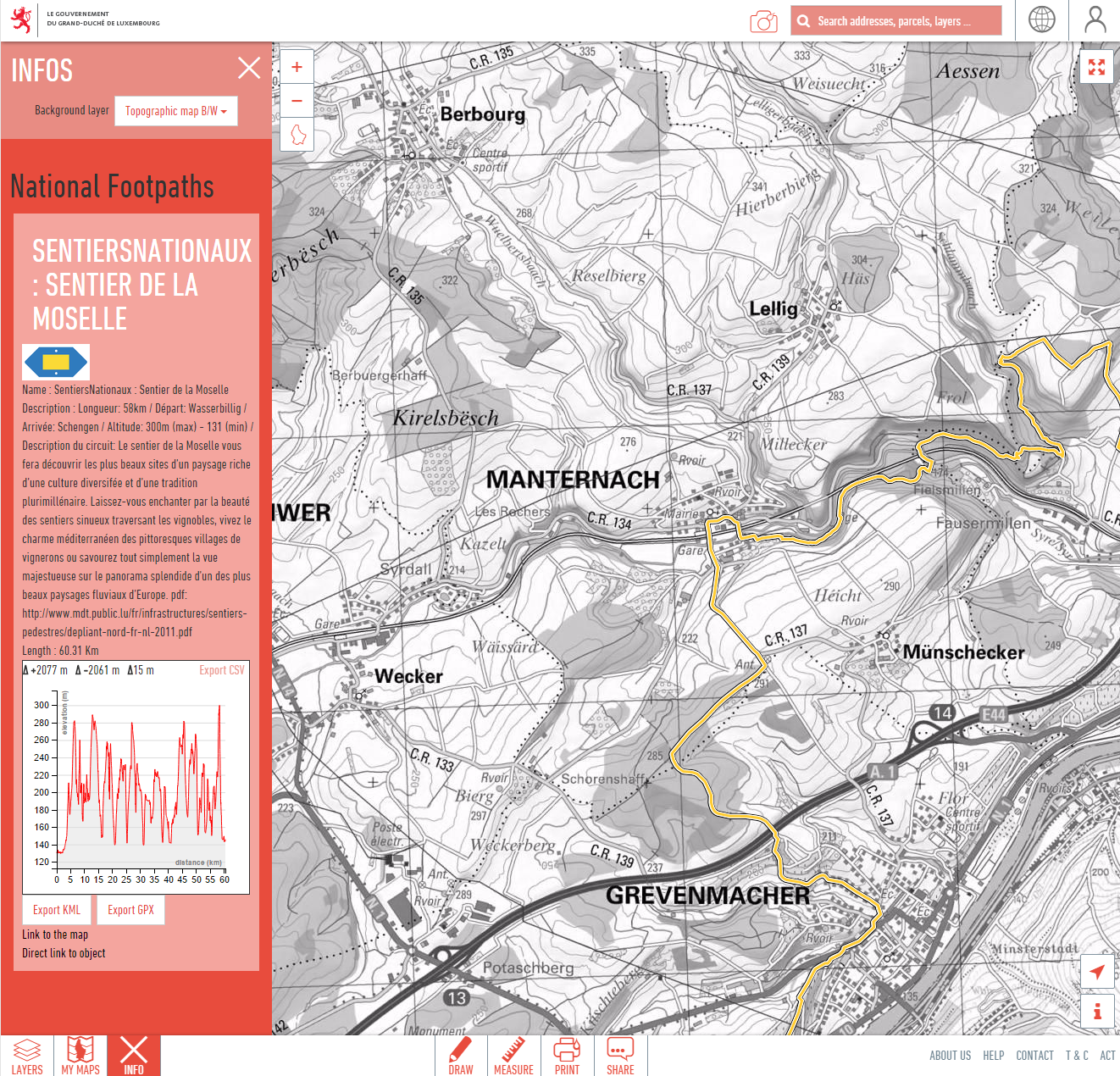
Use the height profile functions or the download link to transfer the trail's geometry to your device (GPX or KML file).
For more information please refer to our online documentation.